Saturday 1st October
Abingdon
0930
drive
1005
Wantage Limborough Road
Wantage Market Place
1030
38
1046
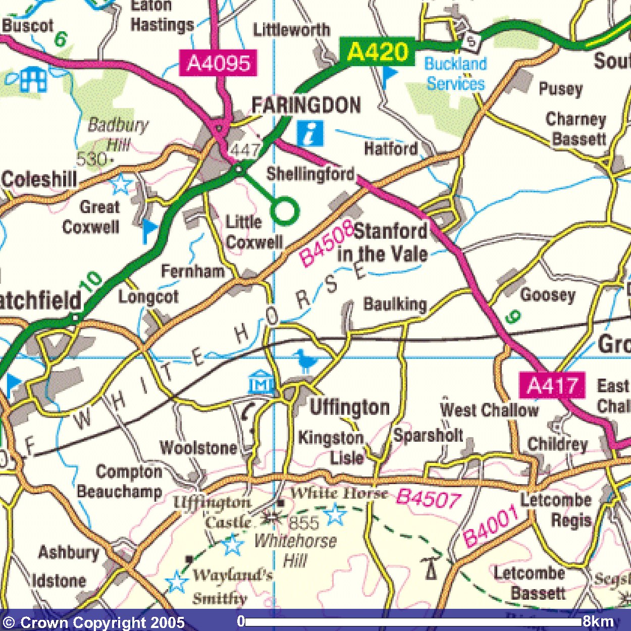
Childrey
1.0
West Chalow
2.0
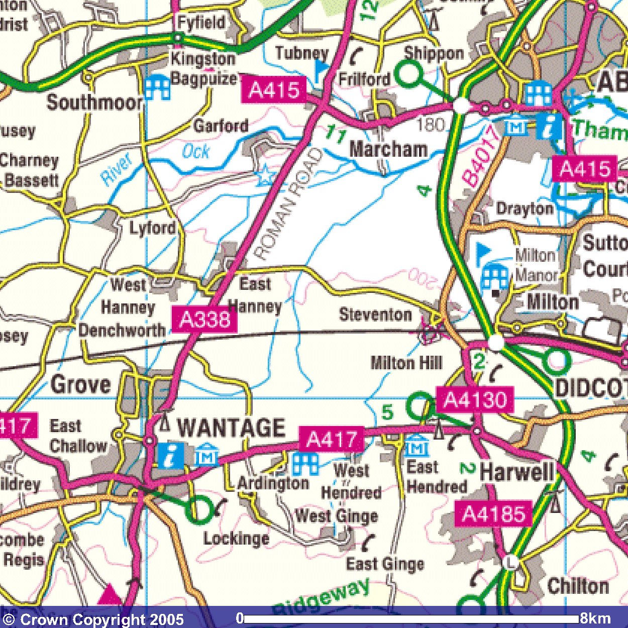
Grove Bridge Farm
1.5
SU420901
0.8
railway bridge
2.0
Willow Barn Farm
1.7
Marsham Mill turn
1.3
A34 crossing
0.8
New Cut Mill
0.7
Thames
0.8
Abingdon
1545 1700 1755 1857
31 31 31 31
1617 1732 1827 1924
Wantage Market Place
Wantage Limborough Road
drive
Abingdon
|
Except for 1 mile at the start and 1.5 miles at the end,
the route for today
follows the line of the old
Wiltshire and Berkshire Canal.
So it's northwards out of Childrey to find the Canal
at West Challow.
Although not marked on the adjacent map,
the OS Explorer map implies that this section of the Canal
has water in it.
The route follows the Canal
which goes eastwards to
East Challow (which is on the second map below).
The Canal then goes alongside the southern outskirts of Grove
and appears as the blue line that is just to the
east of Grove on the map below.
The Canal then turns northeastwards
making a bee-line for the Thames at Abingdon.
Here there are places on the OS Explorer map
where the line of the Canal is
not marked in blue,
and presumably
it may be more difficult to track where it actually goes.
The route leaves the Canal momentarily to cross the A34,
and then tries to follow it through the housing estates of
Abingdon.
There is a Wilts and Berks Canal sign at the point
where it joins the Thames.
|
Day 11
Index
Images produced from the Ordnance Survey Get-a-map service.
Images reproduced with kind permission of Ordnance Survey
and Ordnance Survey of Northern Ireland.
|