Call this a holiday: this morning the alarm goes off at 0550. I leave home at 0630 and drive to Childrey (a few miles west of Wantage) arriving there at 0705. Having found a good place to dump the car for the rest of the day, I discover the Post Office (aka a convenience store) is open. I purchase a pork pie, a packet of crisps, a flapjack and a muffin. The shopowner enquires whether this is breakfast or lunch: I reply that it is lunch, and then ask him (at 0710hrs) as to whether the pub is open all day. Alas it is not.
The bus arrives a few minutes late at 0726. I tell the bus driver that I want to switch to the Swindon bus when we get to Farringdon, and he says that it's a tight connection but he'll see what he can do.
It's a five minute connection but in places I've seen it mentioned that the Swindon bus will wait, but it's not obvious as to how the Swindon bus driver will know whether the Wantage bus has arrived and gone. (The two bus services are run by different companies.)
The bus does the grand tour of villages between Wantage and Farringdon. He has plenty of regulars which is obvious from the friendly exchanges that he has with them. When one young lad gets on he returns the jacket the lad must have left on the bus yesterday. And in the end, many of his customers switch to the Swindon bus. I'm sure he must know this.
On the Swindon-bound bus, I get off at the end of King's Lane near to Longcot. And it's 0.3 miles from here along the A420 to get back onto the D'Arcy Dalton Way. You cross some fields to get to Longcot, and en route I saw some blue berries (what is the name of this plant?) (see photo).
Here is a link to today's photos.
And also before Longcot, the route crosses the River Ock. This is the river that flows into the Thames at Abingdon. Here it is a lot narrower (see photo).
After Longcot, the route first goes under the Didcot to Swindon railway line. Just I was approaching a train went passed, and I managed to catch it with my camera which seems reasonably hard to do with a digital camera (see photo).
At the time I was making my way across the field to go through the bridge that you can see in the photo. It was a muddyish field and many of today's fields were and on many occasions today I used stiles to de-cloy my boots.
The book on the D'Arcy Dalton Way by Nick Moon says that the original arch of this bridge dating from 1840 was extended when the line was widened from two tracks to four tracks in the 1880s. This is shown in the next two photos.
At about 2.8 miles from the A420, the route crosses the line of the Wiltshire and Berkshire Canal. There's water in bits of this Canal but I didn't find the Canal when I got to this point: I was too busy trying to work out how to get through a field of sweetcorn when there was no obvious path. Trying to find the Canal was not possible. (Tomorrow I will be visiting 10 miles of this Canal.)
From here, it's 3.5 miles via Compton Beauchamp to Wayland's Smithy. But it seems a lot more. This is because you don't feel as if you are getting anywhere. It's because the route goes the wrong way, it goes south-eastwards, has a long-distance look at the White Horse (see photo) and then it goes westwards to Compton Beauchamp. You feel as if you spend a lot of time getting nowhere making very little progress in a southerly direction.
The next photo shows an old road called Hardwell Lane.
The next two photos show the church at Compton Beauchamp. The book says that it is the church of St Swithun.
In the fields above the church I got lost, backtracked several times, walked all the way round a large nasty pheasant trap, and eventually found the route.
A mile from Compton Beauchamp (probably three miles the way I went!), the route suddenly does a 90 degree turn and aims SSE up Odstone Hill. This is probably the steepest part of the D'Arcy Dalton Way, but most of the steep bit I failed to notice as I was cursing the stinging nettles: see if you can spot the path in the photo.
And so with one final push, the Ridgeway is met (see photo).
Just round the corner from the sign I met a friendly person from the Oxfordshire County Council who listened to a short version of my exploits! (See photo of him and his dog.) I said I hadn't seen anyone walking the D'Arcy Dalton Way. He said that that was disappointing but people like to walk the Ridgeway. I said that that would be more boring. He also said that he was involved in some improvement works to the D'Arcy Dalton Way last year. I said I had seen the signs about these improvements. (I had noticed that in 1994 they had replaced stiles/footbridges by new wooden ones and replaced others by kissing gates.) He was checking the new signs on the Ridgeway saying that cars and motorbikes weren't allowed during the winter months (starting tomorrow): this was something new this year.
And so to Wayland's Smithy (several photos). As this is where the D'Arcy Dalton Way ends, I persuaded a passing tourist to take my photo. (I'm wearing my ITS Club 9 running vest.)
The route I've chosen from here goes along the Ridgeway to visit the White Horse. This was difficult to find approaching from the Ridgeway and difficult to get a good photo from here.
However, I did get a photo of the pile of stones which presumably get used to feed the horse from time to time.
Today's last photo shows Didcot Power Station away ahead in the mist. This is the view I had whilst eating my delicious lunch. However, lunch was curtailed to pork pie and crisps. Unfortunately, it started raining and the flapjack and the muffin had to be eaten on the move which was not so satisfying. The view of Didcot Power Station shows that the circular trip from Abingdon to Abingdon will soon be over. The walk tomorrow from Childrey back to Abingdon is the final day.
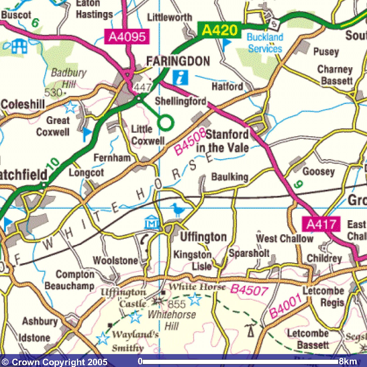
Images produced from the Ordnance Survey Get-a-map service.
Images reproduced with kind permission of Ordnance Survey
and Ordnance Survey of Northern Ireland.